July 4, 2022
As a result of having located a very significant number of the building permits for our neighborhood, I was able to build out a visual timeline, by year, of the development of the homes and other buildings. Though we can look at the development by block, via the chart on each Block Records page, seeing the timeline as a whole for the neighborhood provides a rather interesting perspective. We can clearly see where the home construction started in 1906, the progression to the other blocks, the very active construction years, and the tapering down of the single family home construction after 1920. By 1930, the majority of the open lots in our subdivisions were developed. Then the Depression hit…
I’ve created two versions of the timeline: a quick animation and a slide presentation that you can manually control. To supplement this information, which is not as straightforward to present as one might think, 1924 Sanborn Fire Insurance maps are included after the timeline.
Quick Animation
Comments
- Year designation is based on the year the permit was issued, not the date that the construction was completed.
- Permits were not issued all at once for a specific year. See the Block Records pages for detail.
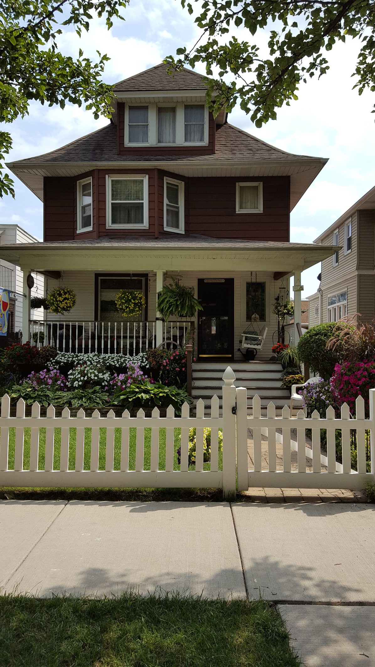
- The focus is primarily on single family residences. Flats, stores, and other commercial buildings are included, if the permits were readily found.
- Any owner/builder is represented – this is not exclusive to Arthur W. Dickinson built houses.
- If a lot has no year (color) designation :
- Permit was not found
- Permit was illegible
- Empty lot
- Due to frequent tear downs and modifications on the commercial streets (Irving Park and Milwaukee), and the highly confusing permit addresses, a “best effort” is represented for development on these streets.
- Some structures that no longer exist are represented – Examples:
- Structures on Cicero (48th Ave) between Warner and Berteau (now a parking lot)
- Structures on 4000 N Laporte (now a parking lot)
- In a few cases, the original structure may have been torn down and replaced with a new one. Examples:
- 4163 N. Dickinson Ave. – 1909 home torn down and rebuilt in 1953
- Warner and Dickinson – 1916 Telephone Exchange building torn down in 1974
Slide Presentation Instructions
Navigate back and forth through the slides manually using the arrows, bottom left, below the slides. On a mobile device, use the navigation arrows or swipe. For better visibility, you can enter full screen mode by clicking on the 3 vertical dots (below the slides) and selecting Full Screen from the menu that appears.
Slide PResentation
SUMMARY – Permit Totals by Year

Disclaimer
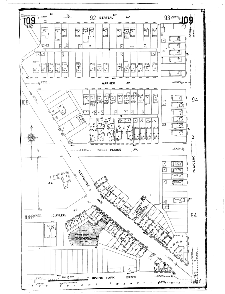
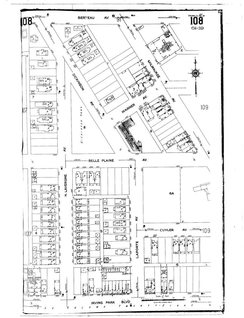
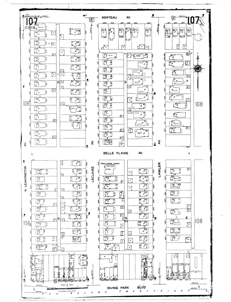
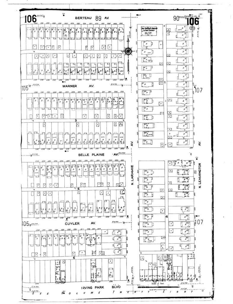
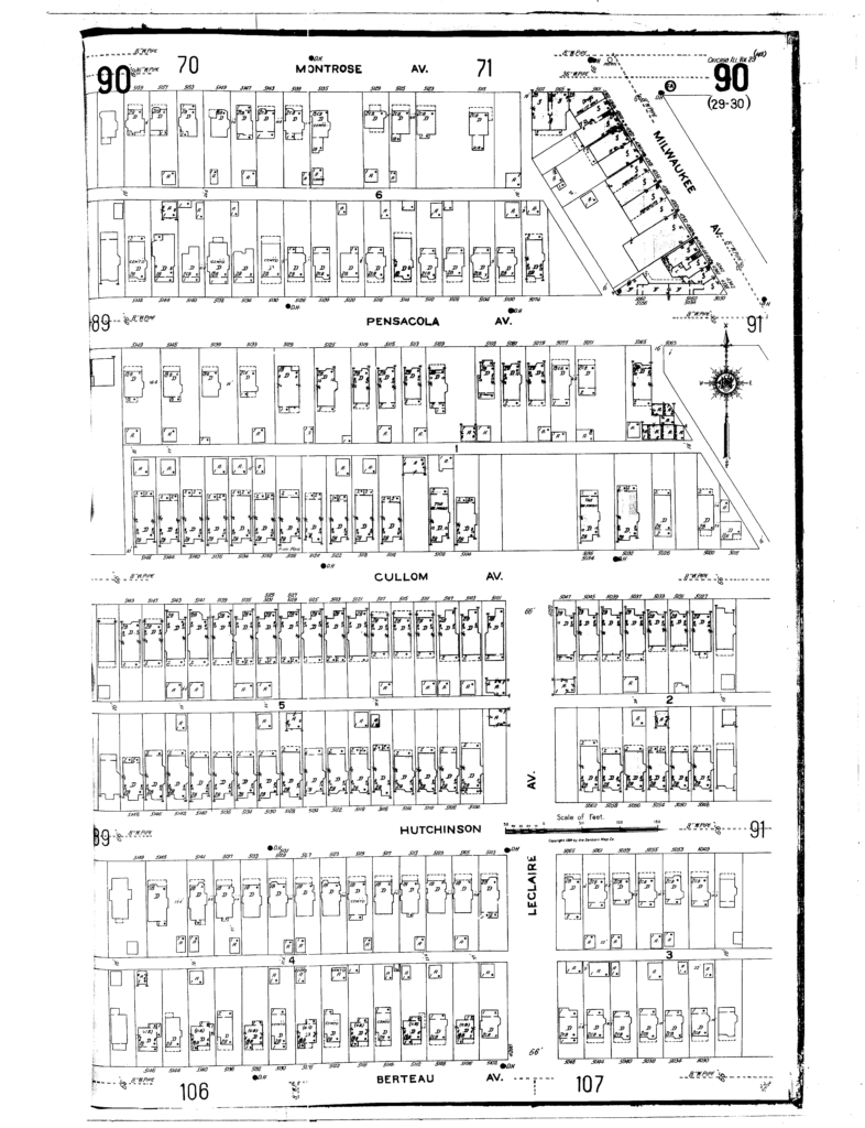
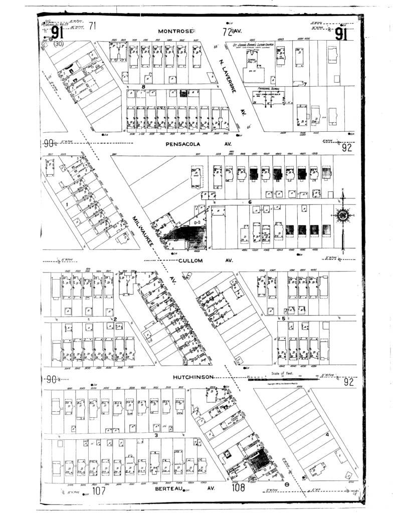
The base map of lots was obtained from the City of Chicago Property Viewer. The slightly angled roads and blocks are an accurate representation (same on Google Maps). The lots on the base map do not always match the information I have located. Therefore, accuracy of the information in the timeline is not guaranteed. Sanborn maps, also, may have some inaccuracies.
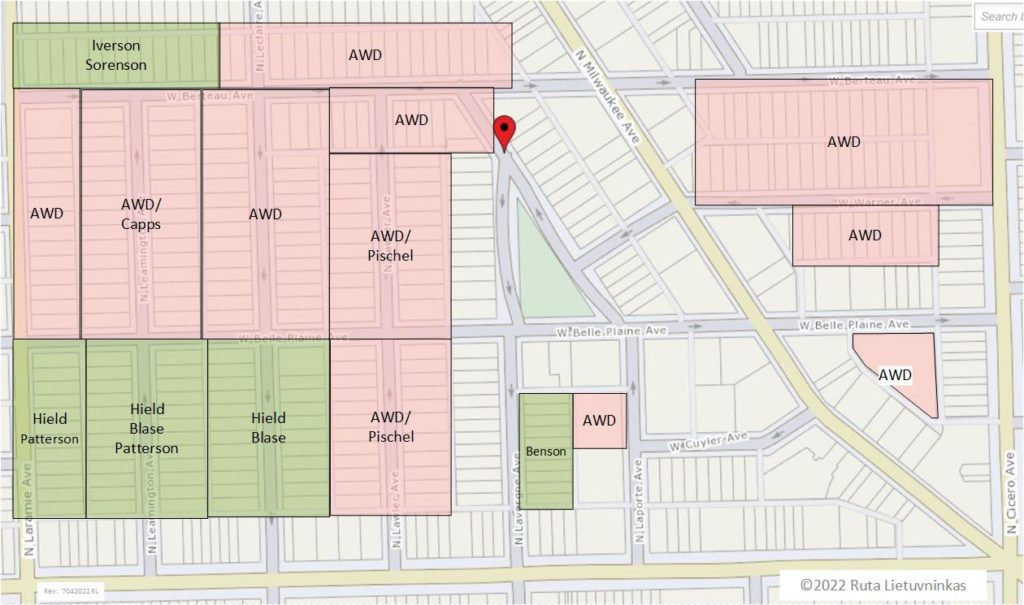
Primary builder/developer
The map below indicates who the primary developer (with exceptions) was for the blocks up until approximately 1920. Homes built after that time were most likely built by someone else. Unlabeled map areas had various owners/developers/builders/architects.
Sanborn Fire Insurance Maps – 1924
Updates/comments
If you have any updates, corrections or additions, do not hesitate to notify me via the Comments area below or via email. Thank you!